Expeditions

The Alpine Club, the world's first mountaineering club, has members from around the world. Since it was founded in 1857, members have been at the leading edge of worldwide mountaineering development and exploration. We aim to be the club of choice for all mountaineers, providing a forum for sharing experiences and information.

Alpine Club members are constantly researching, organising and participating in expeditions to mountains around the world, so it will come as no surprise to find that amongst our members there is a massive wealth of knowledge about remote areas and expedition organisation. The Alpine Club provides a number of resources that will be useful for those planning or researching expeditions. This page provides links to these resources, and to other sites that are invaluable to expedition planners.

The Alpine Journal is a substantial annual record of mountaineering achievement, if you are planning an expedition it should be on your reading list.

Alpine Club Expeditions

The Alpine Club organises annual expeditions, which are often to remote and little-known mountain areas. These expeditions are open to all members, subject to qualifying criteria and numbers. They can be subsidised by the Montane Alpine Club Climbing Fund. This fund also supports expeditions privately organised by club members. .

Read more about Expedition Reports

The Himalayan Index is a key resource, it has been compiled from journals, magazines and books in the Alpine Club Library

Many expeditions will have been awarded Mount Everest Foundation grants and provided reports. There are some details on the MEF website but the MEF does not hold actual copies. These are distributed to the AC and the organisations listed below (but not the Kew archives).

Royal Geographical Society

The RGS holds copies of all MEF reports as well as many others. Searching is very straightforward and summaries are provided. Reports cover the period 1965 onwards and are very comprehensive. They can be consulted by visiting the RGS library, or copies can be e-mailed.

National Archives at Kew

Not the easiest source of information. The National Archives holds many older documents deposited there from multiple sources.

British Mountaineering Council

This is still in beta form but has some impressive features. It is easy to search although not comprehensive. It includes summaries, and you can download many complete reports as PDFs. The BMC is currently the only readily available source of this information.  The AC is working towards publishng a comprehenve expeditions database which will be be available on-line in due course.

Alan Rouse Sheffield Library

Sheffield library holds a comprehensive archive of mountaineering material, including copies of MEF and other expedition reports. There is a PDF catalogue which can be searched; one of the best ways of quickly identifying peaks and leaders. At present it is up to date only to 2010.

Paul and Mick got back from an excellent trip to far West Nepal. They managed to make the first overall ascent of Gave Ding (6571m) via its very impressive north buttress. 

Paul Ramsden reports: The trip was unusually exploratory in that we had no picture of this side of the mountain before we departed and based the whole trip on satellite images from Google Earth (Gave Ding had the biggest shadow in the region).

The trip got off to a poor start when my bags failed to turn up on the flight and the Indian fuel blockade of Nepal threatened to bring everything to a premature holt. However the bags showed up later in the day and some black market fuel got us onto the 16 hour road to Nepalgunj. We flew into Simikot, then the walk into base camp was another four days. The mules stopped a days walk short of the face but near enough for our purpouses. 

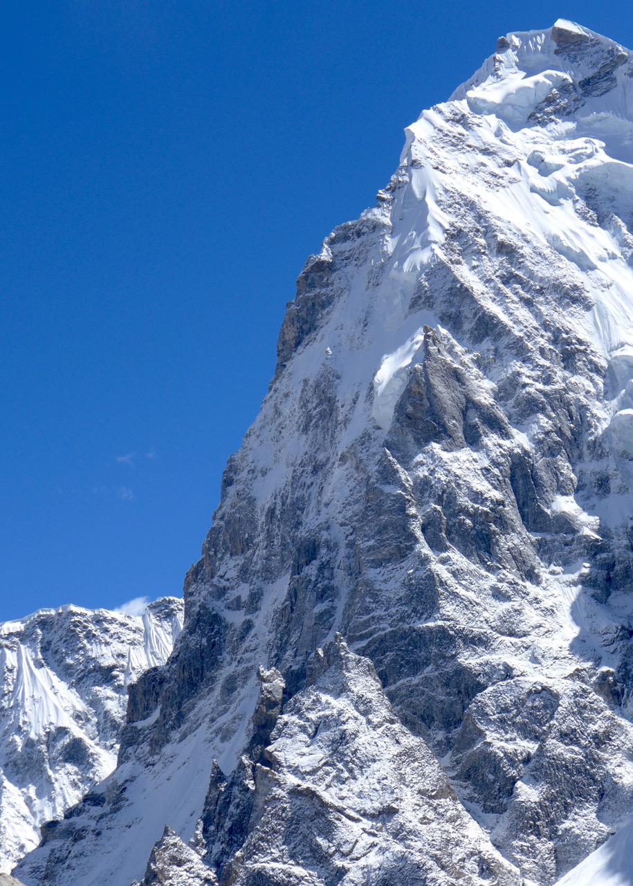
Once we got a good look at the north side of Gave Ding, we knew we were potentially in for a 'good one'.

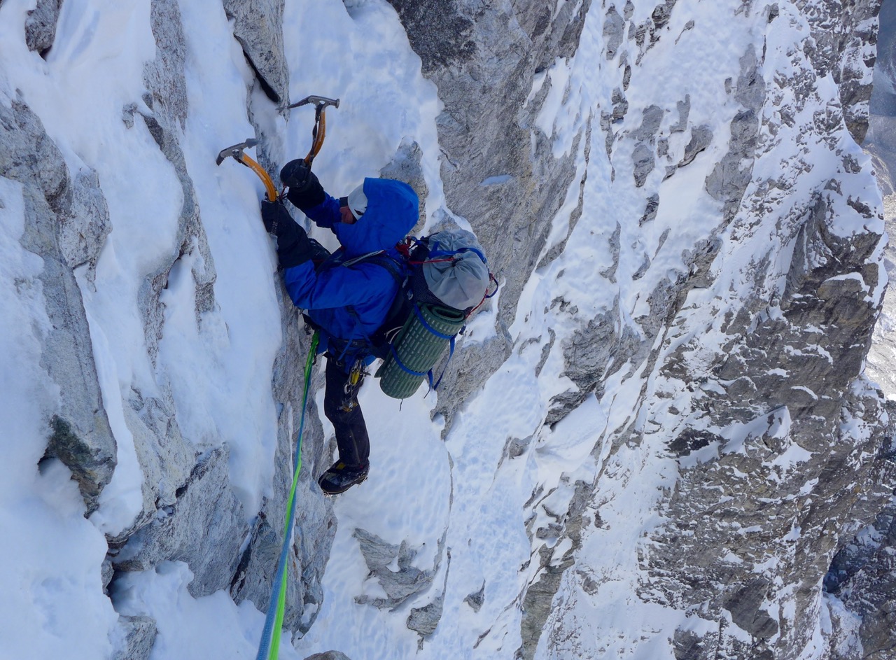
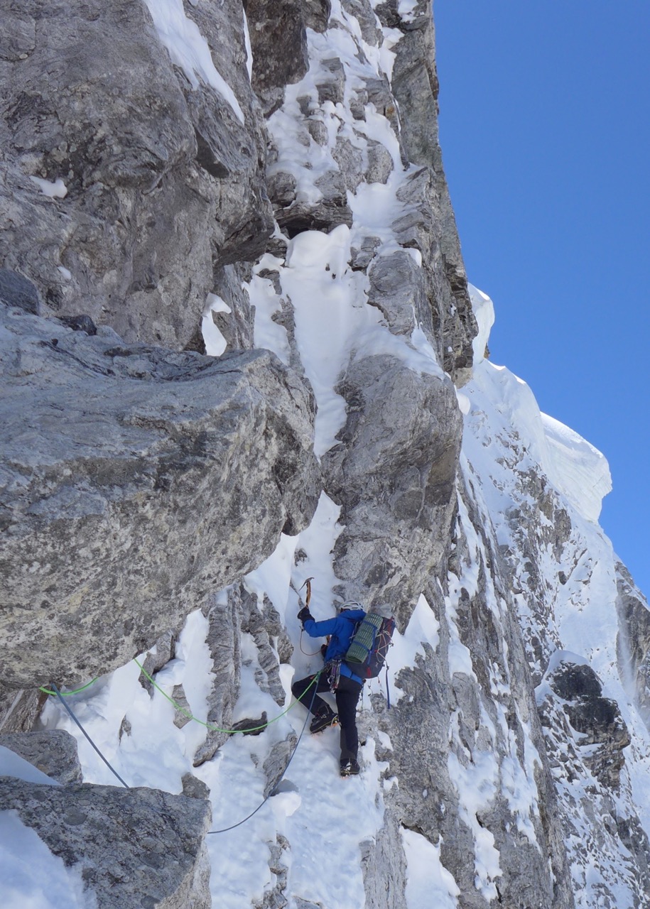
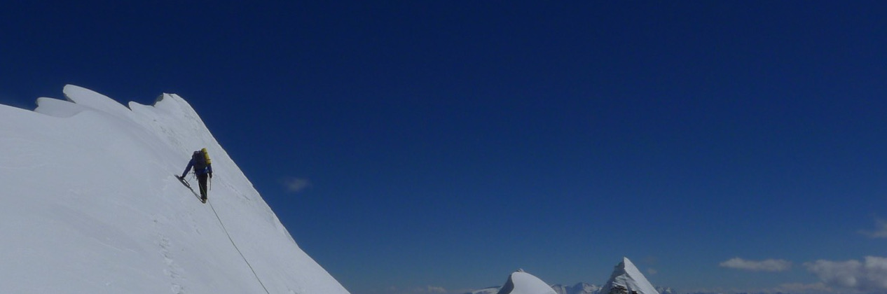
The east and west sides of the north face were threatened by avalanches slopes and serac bands, leaving only one feasible line, pretty much up the centre of the north buttress. The lower section had a lot of steep mixed climbing (wore two teeth of my ice axe picks!) and was quite complex, weaving a route through overhangings and up grooves. A bit reminiscent of the Eiger in the complexity of the route finding. The upper third was more a of a classic steep ridge line, similar to the Peuterey. 

The conditions were unusually cold for this time of year and we both suffered minor cold injuries. The route required five days in ascent and two in descent, initially down the south ridge and then down a colour on the north side (25 Abolakovs). 

Overall it was a real pleasure to climb a virgin summit, via a hard route that offered the only feasible line of ascent from the north side. Grade ED+ 1600m.